Abbadia Lariana
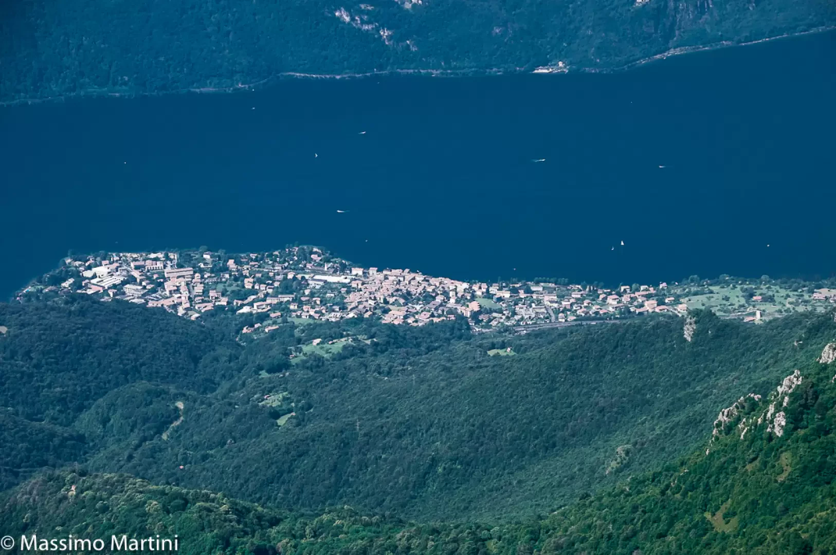 Photo by
Massimo Martini © 2012

Edited by:
Massimo Martini
Access
The town can be reached by car via the state road (Lake Como and Spluga), which runs along the eastern shore of the lake and has a dedicated junction for the town centre. Access by motorway is via the Milan–Venice motorway via the slip road towards Lecco and the subsequent junction onto the , or from the Milan–Varese motorway via the link to the Cinisello Balsamo junction. Abbadia Lariana railway station is situated on the Milan–Lecco–Sondrio–Tirano line, served by Trenord with frequent regional services to Lecco and the Valtellina. Public road transport is provided by inter-urban bus services linking the town to Lecco and to the towns in the Pre-Alpine region. In conditions of heavy traffic or heavy rainfall, the may experience delays in sections with tunnels and on high-altitude bypasses, particularly during the summer months.
Introduction
Abbadia Lariana is a municipality in Lombardy situated on the eastern shore of Lake Como, in the northern part of the province of Lecco, at the mouth of the Val Meria. The built-up area lies on a flat strip directly bordering the lake, at an altitude of approximately 204 metres above sea level, whilst the surrounding terrain rises steadily towards the limestone slopes of the Grigna Meridionale, reaching pre-Alpine landscapes in the Triangolo Lariano area. The municipality borders Lecco to the south, Mandello del Lario to the north, and Ballabio, Oliveto Lario and Valbrona further inland. The place name refers to the presence of an early medieval Benedictine monastic settlement, which laid the foundations for the first forms of permanent settlement in the area. Between the nineteenth and early twentieth centuries, the municipality was involved in the development of the silk industry, a productive activity that characterised the local economy until the phase of progressive industrialisation and subsequent shift towards the service sector.
Description
The municipal area stretches from the lakeshore to the limestone ridges of the Southern Grigna, with a total elevation difference of over 1,600 metres. The coastal strip, which is flat and densely built-up, quickly gives way to slopes carved by torrential valleys: the Val Meria and the Valle dei Mulini shape the inland terrain, channelling the waters towards the lake through wooded gorges and sections with steep gradients. The rock types are dominated by limestone and dolomite, with widespread karst features and rocky cliffs that distinctly characterise the landscape at higher altitudes. The lakeshore features stretches of pebbly beach alternating with landscaped green areas, whilst further inland the masonry structures of ancient water-powered mills, once used for processing local raw materials, are still visible.
The settlement pattern links the main town with hamlets situated at higher altitudes, including Linzanico and Borbino, connected to the main road network by secondary roads and ancient paths running halfway up the hillside. The documented origins of the municipality date back to the Early Middle Ages, a period in which a Benedictine monastery organised the surrounding territory in ecclesiastical and economic terms. The Church of San Lorenzo retains features attributable to the original Romanesque layout, with alterations accumulated over the following centuries. The manufacturing period is documented by the Monti Civic Silk Museum, which houses machinery, samples and documentation relating to silk spinning and weaving practised between the second half of the nineteenth century and the twentieth century.
The Sentiero del Viandante crosses the municipal area, following the mid-slope strip between Lecco and Colico along a historic route of medieval origin that connects villages and places of worship along the eastern shore of the lake. The routes towards Sasso di Preguda and along the Cresta Cermenati provide a link to Mandello del Lario, Ballabio and the Lecco side of the Southern Grigna, in an area popular forsummer hiking and, at higher altitudes, rock climbing.
Information
General information
Area: 16.67 km²
Altitude of the main town: 204 m
Highest point: 1,875 m – Cresta Cermenati / Southern Grigna
Population: 3,135 (as at 30 November 2025)
Name in dialect: Badia
Demonym: abbadiensi
Patron saint: Saint Lawrence
Neighbouring municipalities: Ballabio – Lecco – Mandello del Lario – Oliveto Lario – Valbrona
Province: Lecco
Region: Lombardy
Country: Italy
Official website: https://www.comune.abbadia-lariana.lc.it